Technical depth, modern tools and proven methodologies.
We pair certified professionals with licensed, industry-leading software to deliver intelligent, accurate and forward-looking engineering outcomes.
Technical Expertise
Our principal engineers and project managers hold professional engineering and project-management certifications including PrEng, PMP and Consulting Engineering accreditations.
We have specialised knowledge in areas such as seismic design and unique construction methodologies, project pre-planning, project risk management and project scheduling.
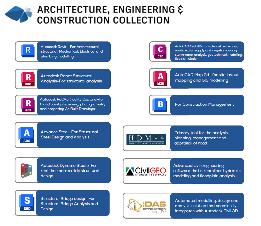
We hold genuine licenses and proficiency in advanced engineering software, including Autodesk AEC, HDM-4, GeoHECRAS, HEC-RAS, HEC-HMS, ArcGIS, QGIS and Microsoft Project.
Innovative Approaches
We deploy cutting-edge techniques and technologies to achieve results for our clients' projects — including drone surveying and IDAS-based design integration.
Our digital workflow connects design, analysis and construction management into a single, model-driven environment.
Autodesk Civil 3D
External civil works, roads, water supply and irrigation design, stormwater analysis, geotechnical modelling and wastewater management.
Autodesk Revit
Architectural, structural, mechanical, electrical and plumbing modelling for integrated buildings delivery.
Autodesk Robot Structural Analysis
Advanced structural analysis and verification of complex structures.
Autodesk Bridge Design
Structural bridge analysis and design for highway and pedestrian crossings.
AutoCAD Map 3D
Site layout mapping and GIS modelling for spatial planning.
Drone Surveying & IDAS
High-resolution aerial data capture and automated design integration with Civil 3D.
Software & Modelling Applications
Infraworks Development LTD utilises a range of advanced technical software to support modelling and analysis across civil and structural engineering applications. The firm maintains an active Autodesk Architecture, Engineering & Construction (AEC) Collection license, operated on high-performance workstations equipped with suitable graphics capabilities for rendering and data processing. We also use Microsoft Project for project scheduling and management, and ArcGIS for spatial planning and data management.